After issuing a mea culpa over the image of an Android bot urinating on an Apple logo that popped up in Google Maps a few weeks ago, the company now it’ll be temporarily shutting down editing on Map Maker so it can deal with the problem of abuse. [More]
maps
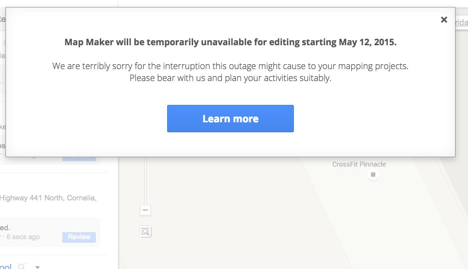
Google Temporarily Shutting Down Editing In Map Maker After Incident With Urinating Robot
By 5.11.15
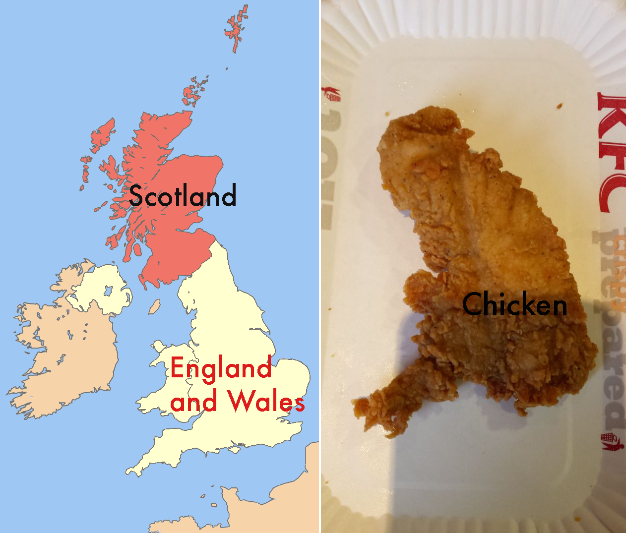
KFC Customer Claims His Dinner Has Foretold The Outcome Of Scotland’s Independence Vote
By 9.17.14
While the United Kingdom stands poised on the brink of a possibly fractured future, one man says he already knows the outcome of Scotland’s vote on independence: It’s going solo, according to a piece of chicken he bought from KFC. Well, that’s decided. [More]
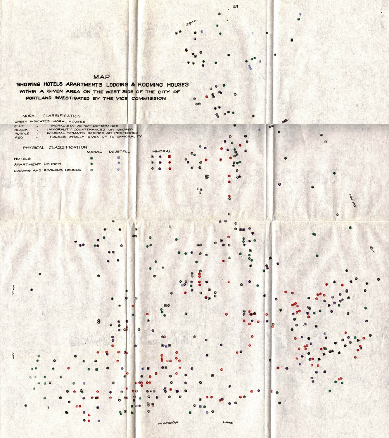
101 Years Ago, Someone Mapped The Morals Of Portland, Building-By-Building
By 9.4.14
Long before there were interactive police blotter maps, or even funny maps labeling neighborhoods with tags like “Yuppies with Puppies” or “Bars You’re Too Old To Go To,” the city of Portland (the one on the upper-left of the map) actually plotted out which rental homes, hotels, and apartment buildings had been investigated and deemed to be “moral,” “immoral,” or “doubtful.” [More]
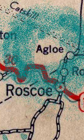
How Mapmaker’s Anti-Piracy Methods Turned An Imaginary Town Into A Real Place
By 3.19.14
When was the last time you wondered if a map’s information had been lifted from another source? Probably never, because a map is a map is a map, right? You can’t really steal information about the physical world because it’s there for the taking. But it turns out there is such a thing as piracy in mapmaking, and one company’s attempt to keep copiers away brought an imaginary town into the real world. [More]
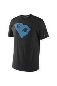
Nike Pulls Panthers T-Shirt Because North Carolina Is Not Shaped Like South Carolina
By 7.18.13 — Updated: 7.17.13
States come in all kinds of funny shapes and sizes — that one’s squiggly, that one’s a rectangle and that one is a mitten, see? — so we can see how someone just eyeballing a state’s outline could get it wrong. Perhaps someone at Nike forget to check a map before printing up a batch of Carolina Panthers T-shirts with the team logo and an “NC” inside a the outline of a state. [More]
Still No Google Maps App For iOS 6, But You Can Now Access Street View
By 10.4.12
As many people with an iOS device noticed when they upgraded to iOS 6, their Google Maps app had vanished into the ether, replaced with a map app that even Apple admits maybe isn’t that great right now. For people who still wanted to use Google Maps, they could still view them via a web browser, and now Google has turned on Street View. [More]

Design A Safety Map To Plan For Disaster
By 5.21.11
There’s a reason your office building probably has a fire evacuation map posted on a wall. When things get crazy, it’s best to have a plan in place for how to react, and a map with a rendezvous point for friends and loved ones could prove invaluable during earthquakes, fires and floods — not to mention the apocalypse. [More]

Test Your Broadband Speeds For The FCC
By 3.15.10
Last Thursday, the FCC started collecting information from consumers about the quality of their broadband service. If you’ve got a PC that can run Java, you can go to Broadband.gov and run the test now. (The FCC will collect your IP address and physical address, but not your name or email address, reports Wired.) If you’ve got an iPhone or Android smartphone, you can download an app to measure your connectivity and report it. [More]
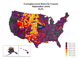
Animated Map Of Rising US Unemployment Since 2007
By 11.23.09
It’s like watching a slow-motion video of cirrhosis of the lung.

Unemployment Visualized As A Zombie Outbreak
By 10.12.09 — Updated: 2.28.13
At some point, we’re going to have to stop referring to every red-hued outbreak map as being zombie-like, but this is not that point. It’s nearly Halloween, the #2 movie in the nation is Zombieland, and yesterday the president of the Federal Reserve Bank of St. Louis warned that unemployment may exceed 10% before the end of the year. This is the appropriate way to view unemployment today.

US Postal Service Redefines "Contiguous" United States
By 10.2.09
Steve was mailing some packages from his home in Virgina to various points in the country, and noticed something strange on his receipt. The packages destined for Pennsylvania and Washington state are leaving the contiguous United States. What?

Target Advertises To Overhead Planes, Orbiting Satellites, Alien Life Forms
By 5.12.09
Joshua sent us this link to the Google Maps aerial view of a Target store in Alexandria, Va. There’s something to be said for branding, advertising, and taking advantage of unused space, but maybe a giant bulls-eye isn’t the logo to start with.

Power Trip: Interactive Map Shows the U.S. Electric Grid
By 5.1.09
This is the weirdest weather map you’ve ever seen. Sort of. It shows the solar power capacity of different regions of the U.S. It’s the coolest-looking slide from an interactive map compiled by NPR to illustrate this week’s series about America’s power grid. It shows power sources and where they’re located, and also the larger infrastructure that carries our electricity from those sources to our homes.
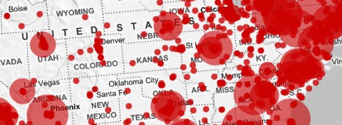
Track The H1N1 Swine Flu Across The Globe
By 4.27.09
Everyone’s still unsure whether the H1N1 Swine Flu is a mild outbreak or something worse, but in the meantime you can amuse yourself with this grim Google Map of suspected and actual cases around the globe. It will give you something to do until the time comes when you have to decide between joining Randall Flagg or Mother Abagail.
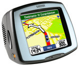
Following Garmin's Replacement Instructions Could Cost You $99
By 4.12.09
Garmin wants to bill reader Hal $99 for a new SD card after failing to tell him to remove his old card before returning his dead-on-arrival StreetPilot C510. The SD card holds the unit’s maps, and without one, the GPS unit is useless.
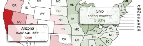
See The Bank Failure And Foreclosure Rates In Your State
By 2.27.09
CNN Money has put together a couple of quick interactive maps of the U.S. that let you see the bank failure rates and foreclosure rates for each state. According to these two maps, Wyoming is the place to be.
Animation: Target's Spread Across The U.S.
By 2.23.09
Last summer, we highlighted an ominous-looking animation that traced the spread of Walmart stores across the American landscape over the past 5 decades. Now the same guy behind that map has put together a new one, this time tracing Target’s growth.
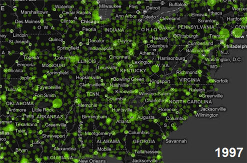
Watch Walmart Spread Across The Country Like A Virus
By 7.11.08
We’ve seen “Walmart is a virus” videos before, but this interactive map showing the proliferation of Walmart from the early 1960s until 2007 is especially cool. Zoom in and out as the Walmart infection grows…